About Us
Company Background
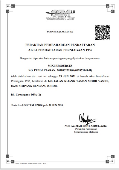
Mixi Resources is a fully Malaysian Bumiputera owned company. Mixi Resources was founded on 21st June 2018 with regards to the Registration of Business Act. 1956. This company was established to fulfill current demand project mainly in Geology. We also provide experienced and skilled workers to ensure a top-notch work quality, solely in promising excellent services in every project executed.
- Geotechnical Services
- Geological Services
- Geophysical Services
- Civil & Structure Engineering Services
The comprehensive information we provide is used to minimise the cost, time and technical risk to the projects. Whether these risks are form unforeseen design, we can fill in the gaps and provide extensive information that cannot be obtained from the traditional and convential approches.


Our Services
Mixi Resources Sdn. Bhd. will focus mostly on geological and geophysical services to meet the demand of this industry. Below are services that we offer:
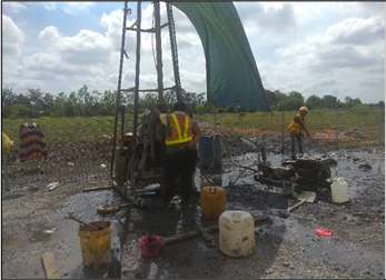
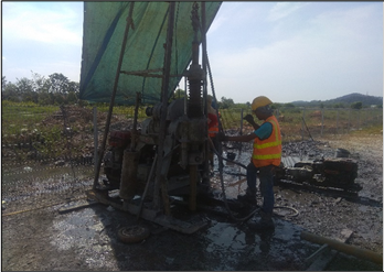
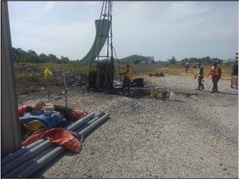
Geotechnical Testing and Services
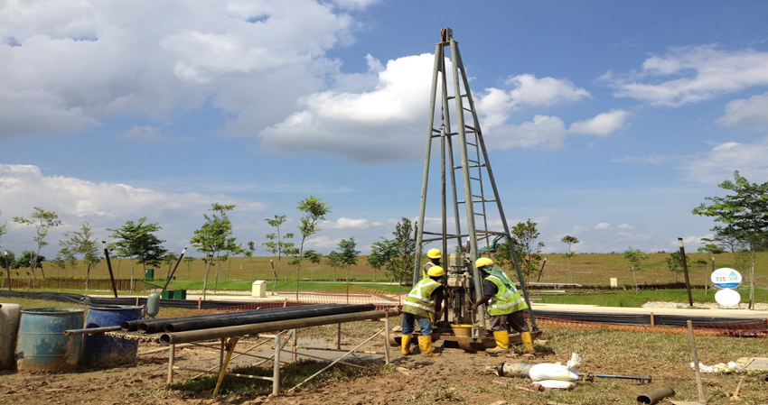
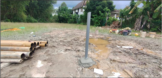
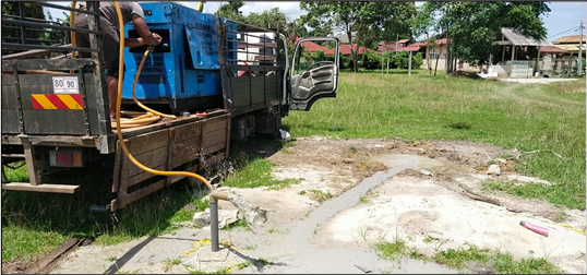
Standard Penetration Test, Soil and Rock Sampling, In-Situ Testing, Underground Water Drilling and Exploration
Supply, Install and Monitor Real-time Instrumentation
Construction, survey, geoforensic and maintenance building and infrastructure (Settlement Instrument, Tiltmeter, Inclinometer, Vibration Wie Piezometer, Prism, ELB and etc)
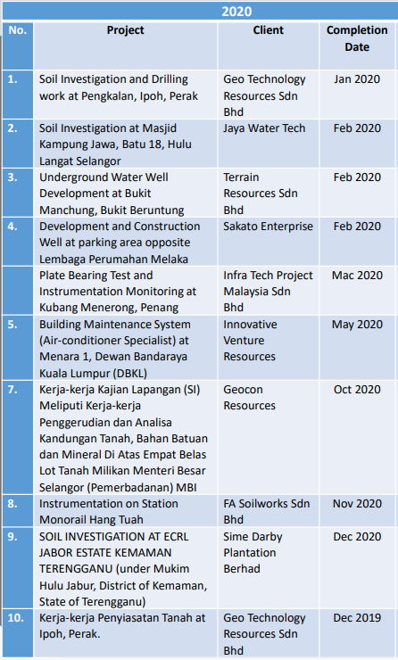
Our Project
We are proud of the projects we have safely and expertly delivered for our clients and are proud of our current of dynamic projects.
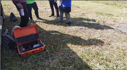
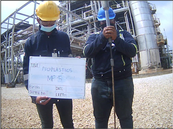
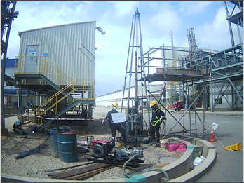
MULTI CHANNEL ANALYSIS OF SURFACE WAVE
- Kerja-Kerja Penyiasatan Tanah Dan Pengujian Makmal Bagi Projek Cadangan Pembinaan Ruang Tambahan, Pemasangan Landasan Dan Stesen Platform Di UNIKL MFI Bangi, Selangor (2021)
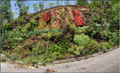
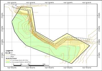
ROCK SLOPE STABILITY ASSESSMENT
- Cadangan Pelan Susun Atur Operasi Pengkuarian Di Atas Tanah Hakmilik LOT 5243 PN 9533, Mukim Serendah, Daerah Hulu Selangor, Selangor Darul Ehsan. (2021)

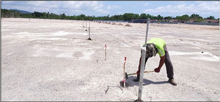
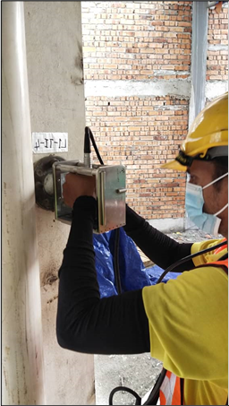
INSTRUMENT INSTALLATION AND MONITORING
- Cadangan Membina Dan Menyiapkan 200 Unit Rumah Teres Mampu Milik Serta Kerja-Kerja Yang Berkaitan Di Atas Tanah Kerajaan Di Kampong Gong Chengal,Mukim Kemasik, Daerah Kemaman, Terengganu Darul Iman (2021)
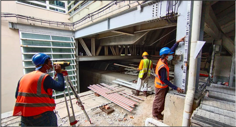
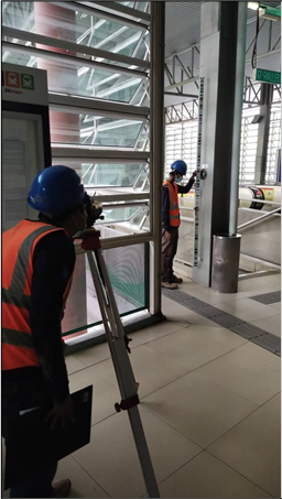
INSTRUMENT MONITORING
- Cadangan Tambahan Dan Perubahan Serta Menaiktaraf Kepada Stesen Monorail Hang Tuah Yang Sedia Ada Di Atas Lot 790 Dan Lot Pt 140, Seksyen 56 Di Jalan Hang Tuah, Wilayah Persekutuan Kuala Lumpur (2021)
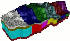
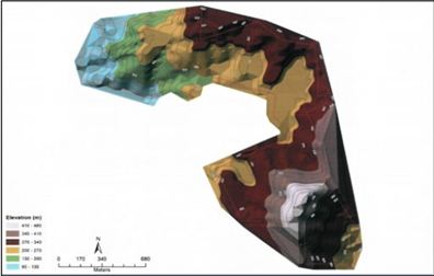
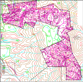
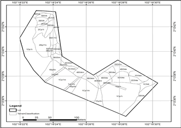
GEOLOGICAL TERRAIN AND SLOPE MAPPING
- Cadangan Pelan Susun Atur Operasi Pengkuarian Di Atas Tanah Hakmilik Lot 5243 Pn 9533, Mukim Serendah, Daerah Hulu Selangor, Selangor Darul Ehsan.(2021)

GEOLOGICAL TERRAIN AND SLOPE MAPPING
- Kerja-Kerja Penyiasatan Tanah Dan Pengujian Makmal Bagi Projek Pembinaan Bangunan Tambahan Jabatan Pendidikan Melaka Di Tapak Bahagian Teknologi Pendidikan Melaka, Melaka.(2021)

List Our Project


Why choose us?
We work closely together to provide a service and quality products which far exceeed the industry standards.On the basis of our basis of our expertise, the company provides advice, generally for purposes related to the construction, the mining industry and goverment bodies.

Mixi Resources is mainly operate in Geological Mapping, Geophysics, Soil Investigation, Underground Water Exploration and Real-time Instrument services. We are very dedicated in our services as parallel with our goal to ensure a sustainable development.
Our teams consist of qualified and competent civil engineers, electrical electricians, geologist and geotechnical engineers that ensures every job, no matter the size and complexity is carried out in a safe and professional manner.
Our Mission
To ensure our service always in high quality and integrity to fulfill the total need of client.
Our Vision
We strive for quality improvement and marketable development exclusively in geological and geotechnical works
To provide good work management with optimization of output, cost and time
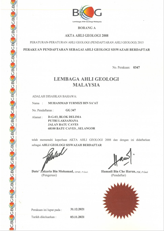
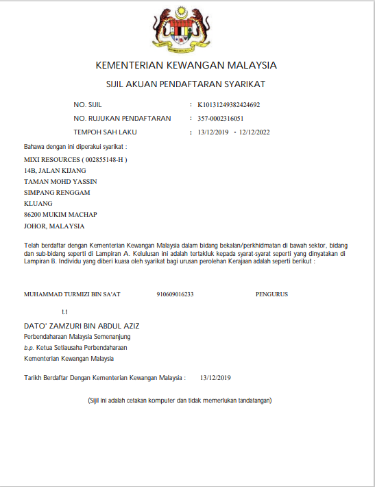
Certificate Registration

Clients
Projects
Hours Of Support
Hard Workers
Call To Action
Mixi Resources. (002855148-V) is a leading geological and geotechnical engineering service provider in Malaysia. The principle is innovative, creative and optimistic. We are customer-oriented and we believe in teamwork.
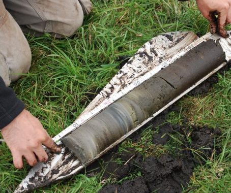
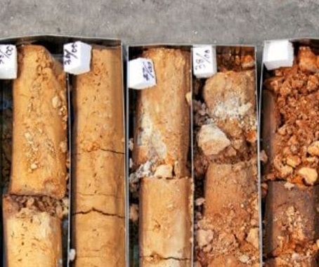
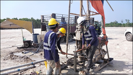
Soil Investigation
Our soil investigation services can be customized for geotechnical purposes, groundwater explorations, and others. Mixi Resources drill crews normally consist of skilled site supervisor assisted by other crews were trained to classify soils and bedrock.
◉ Undisturbed / Piston Soil Sampling
◉ Standard Penetration Test (SPT)
◉ Cone Penetration Test (CPT)
◉ Inclinometer Installation
◉ In-situ Permeability Test
◉ Piezometer Installation
◉ Mackintosh/JKR Probe
◉ Field Vane Shear Test
◉ Diamond Rock Coring
◉ Pressuremeter Test
◉ Mazier Sampling
◉ Packer Test
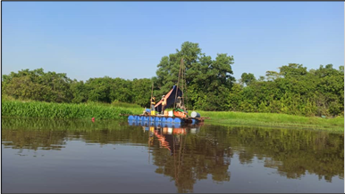
Groundwater Exploration & Development
Mixi Resources Sdn.Bhd. can help you to locate groundwater resources for domestic use, agricultural, or industrial purposes with highly experienced manpower, equipment, and heavy machineries. In some areas, the use of groundwater as a water resource might be more economical than the traditional piped surface water.
Groundwater is often cheaper, more convenient and less vulnerable to pollution than surface water. Therefore, it is commonly used for public water supplies. The presence of groundwater might harm the surroundings in certain situation. Besides exploring, Mixi Resources is capable to help you with dewatering & control services of groundwater for geotechnical purposes.
◉ Groundwater feasibility study & modelling
◉ Soil, groundwater sampling and monitoring
◉ Horizontal collector well (HCW) design
◉ Groundwater treatment and remedial
◉ Groundwater dewatering & control services
◉ Groundwater deepwell drilling
◉ Pumping and recharge test
◉ Tubewell design & construction
◉ Downhole probe logging
Our Portfolio
- All
- Geological Services
- Geotechnical Services
- Geophysical Services


Team
We are always looking for talented, passionate people both experienced professionals and recent graduates across a wide range of disciplines. We want individuals who share our Core Values and who demonstrate a true passion for what they do, whether in the field or in the office.

Turmizi Saat
Director and Marketing
Amir Salihin
GeologistOrganization Chart

Our Clients


Article
Here Lies The Answers
-
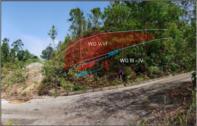
Dormant Landslide – How to Overcome This Problem?
Old-dormant landslide is an inactive landslide that can be reactivated by its original causes or other causes that will trigger its mechanism. It is normally overshadowed by thick and densely forested, wet tropical hilly terrain and highlands. The older the landslide, the more difficult for it to be recognized although the causes of movement remain apparent. Due to these reasons, local geoscientists tend to ignore this type of landslide. Dormant landslide can be classified as a serious natural terrain geohazard and can cause very costly consequences. This is because it can re-collapse or still in the process of collapse without any significant trace. Besides human interventions such as deforestation and mining, it also can be triggered by extreme natural events such as earthquakes and heavy rainfall. These things will affect the structure and mechanical stability and make the soil vulnerable to oversaturation and erosion (Salleh et al., 2019).
-
Multichannel Analysis of Surface Wave (MASW)
MASW evaluates ground stiffness by measuring shear-wave velocity (Vs) of subsurface in 1-D, 2-D, and 3-D for various types of geotechnical engineering projects in the most common depth range of 0-30 meters. Shear-wave velocity (Vs) is one of the elastic constants and closely related to Young’s and shear moduli. Under most circumstances, Vs is a direct indicator of the ground strength (stiffness) and therefore commonly used to derive load-bearing capacity.
-
Seismic Refraction Surveying
Seismic refraction determines depth to bedrock and bedrock structure. Due to the dependence of seismic velocity on the elasticity and density of the material through which the energy is passing, seismic refraction surveys provide a measure of material strengths and can consequently be used as an aid in assessing rippability and rock quality. The technique has been successfully applied to mapping depth to base of backfilled quarries, depth of landfills, thickness of overburden and the topography of groundwater.
-
Seismic Reflection Surveying
Seismic reflection surveying is the most widely used geophysical technique, and has been since the 1930s. Its predominant applications are hydrocarbon exploration and research into crustal structure, with depths of penetration of many kilometres now being achieved routinely. Since around 1980, the method has been applied increasingly to engineering and environmental investigations where depths of penetration are typically less than 200 m. Applications of shallow high-resolution seismic reflection surveying include mapping Quaternary deposits, buried rock valleys and shallow faults; hydrogeological studies of aquifers; shallow coal exploration; and pre-construction ground investigations for pipe, cable and sewerage tunnel schemes, and offshore wind farms.
-
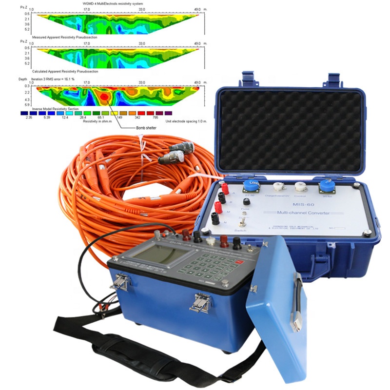
Electrical Resistivity Imaging
Electrical resistivity methods were developed in the early 1900s but have become very much more widely used since the 1970s, due primarily to the availability of computers to process and analyse the data. These techniques are used extensively in the search for suitable groundwater sources and also to monitor types of groundwater pollution; in engineering surveys to locate subsurface cavities, faults and fissures, permafrost, mine shafts, and so on; and in archaeology for mapping out the areal extent of remnants of buried foundations of ancient buildings, amongst many other applications. Electrical resistivity methods are also used extensively in downhole logging. For the purposes of this chapter, applications will be confined to the use of direct current (or very-low frequency alternating current) methods
-
Spontaneous (Self) Potential Methods
The self-potential or spontaneous polarisation (SP) method was devised in 1830 by Robert Fox, who used copper-plate electrodes connected to a galvanometer to detect underground copper sulphide deposits in Cornwall, England. The method has been used since 1922, when Schlumberger introduced non-polarisable electrodes as a secondary tool in base metal exploration, characteristically to detect the presence of massive ore bodies, in contrast to the induced polarisation method (see Chapter 9) which is used predominantly to investigate disseminated ore bodies. The SP method has been extended to groundwater and geothermal investigations, and can also be used as an aid to geological mapping, for example, to delineate shear zones and near-surface faults. It has also been used in forecasting earthquakes (e.g. Corwin and Morrison, 1977; Varotsos and Alexopoulos, 1984) and volcanic eruptions (Zablocki, 1976), and investigating volcanic plumbing (Patella, 1997a; Lenat, 2007). The technique has also been used successfully in archaeological investigations (Wynn and Sherwood, 1984; Drahor, 2004). The method is increasingly being used in environmental studies such as in monitoring fluid contamination and bio-remediation. A useful general introduction to the method has been given by Corwin (1990).